


| TRAIL TYPE | NAME | TIME | DISTANCE |
|---|---|---|---|
| PR-A 379 | LA CALDERONA | 3h | 13,8 km |
The trail begins at kilometre 39.4 of the A-351 towards El Saucejo. At this point, a stabilised gravel road begins next to an electrical substation. Continue until you pass through an underpass beneath the A-92. A little further on, continue along the Vereda de la Calderona, crossing the Arroyo Salado stream and entering the agricultural areas of Las Salinas and Los Enredaderos.
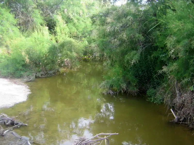
Amidst olive groves and cereal fields, across this flat countryside, we arrive at the so-called Viñas de los Llanos, where we turn right onto the Vereda del Peinado, named after the stream that runs parallel to it. Here, you can enjoy a riverside landscape where tamarisk groves are the main feature, covering several hectares. We will find the remains of the Peinado farmhouse and some centuries-old olive groves, now overgrown, on the left side of the Peinado riverbank. Shortly before reaching the Otero farmhouse, we will turn right again onto the municipal public road called Urraco, which takes us back to the start of the trail through the San José farmhouse area. Before that, we will have to cross the Arroyo Salado stream again, whose bed is covered with a large amount of vegetation at this point. Through this area of Las Vegas and taking the A-92 service road, we will reach the start of this trail.
El Peinado stream
The Peinado and Término streams originate in the protected area of Pinalejo, where Osuna's main landmarks are located: La Gomera (810 m), El Gomerón (754 m) and Los Higuerones (605 m). All of them are located within the area that the Catalogue of Protected Areas and Assets of the Province of Seville refers to as ‘Pinalejo’. The Peinado stream is 33.5 km long within the municipality of Osuna.
Within the municipality of Osuna, this area is located in the south-western sector, bounded by the Osuna-El Saucejo road at km 10.5 to the Puerto de los Barrancos Blancos (km 16.5) in the eastern sector. Its north-western boundary is formed by the Osuna-El Puerto la Encina road from km 12.5 to the district itself, The rest of the boundaries coincide with the municipal boundary to the south and the almost straight line between Puerto de la Encina and Higuerones to the north.
The area is drained by these streams with a moderately high torrentiality coefficient and watercourses with a high percentage of salinity. In this area, we can find beautiful and lush gallery forests.